

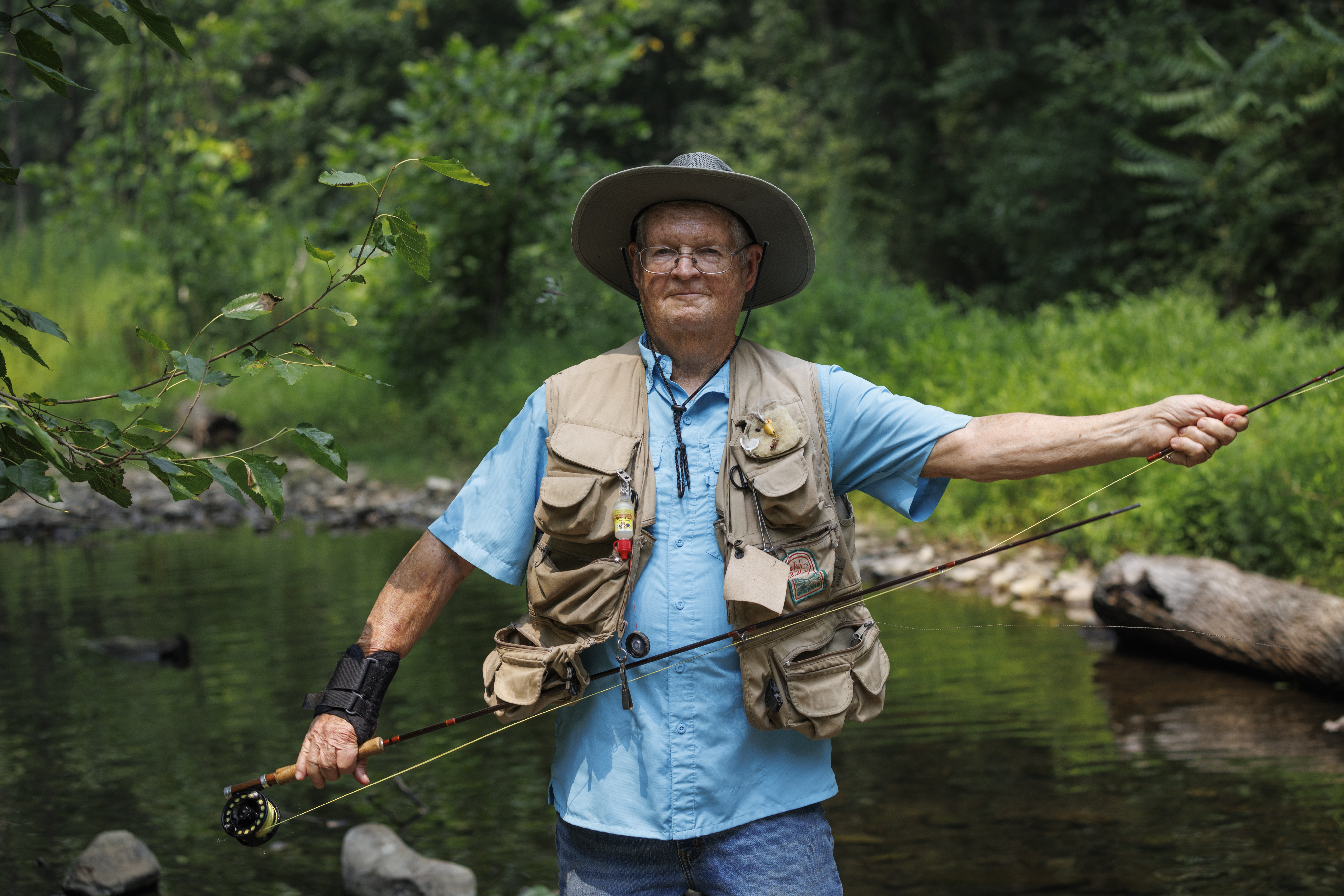
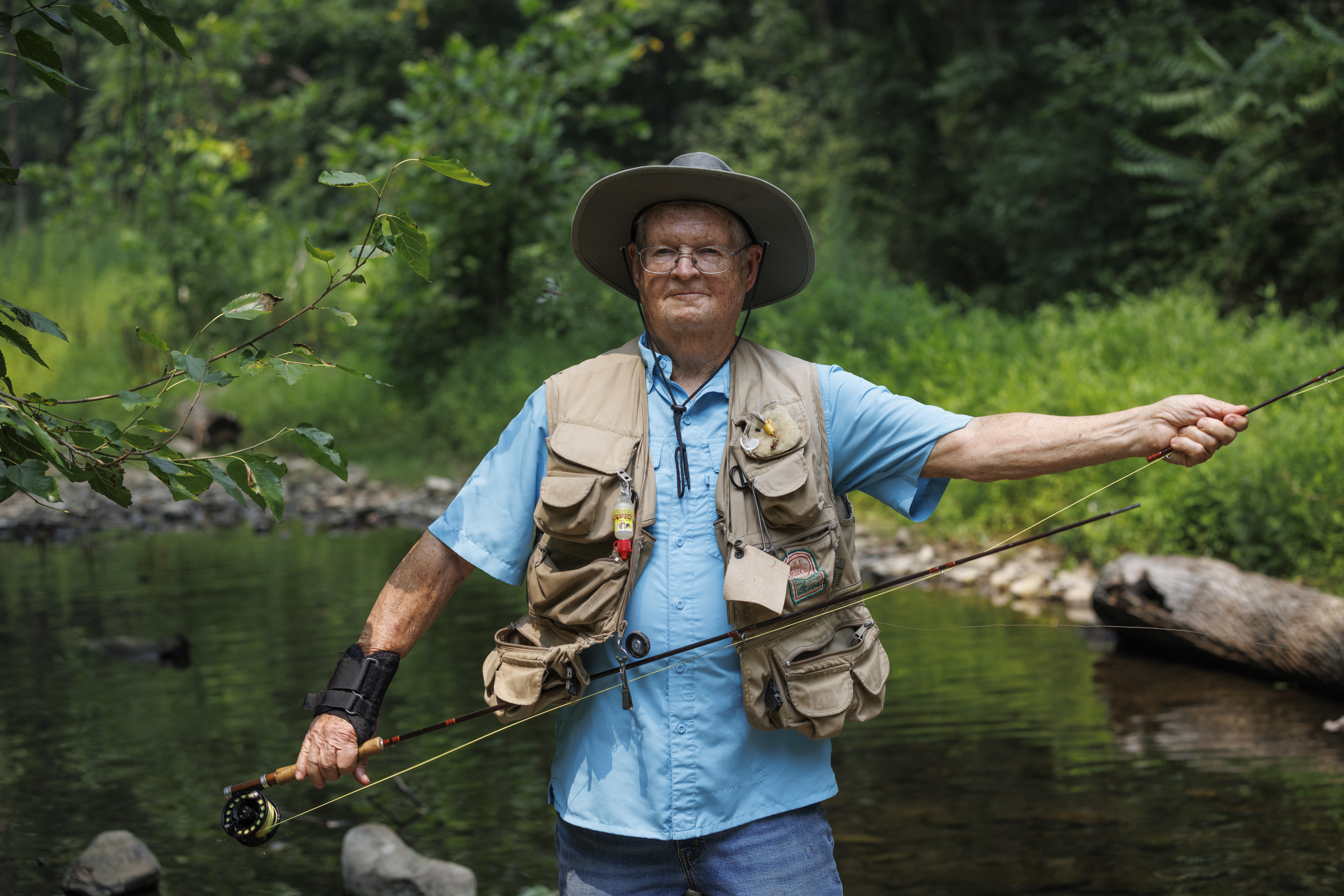
Fly fisherman Roger Flinchum remembers evenings when Rappahannock County streams were alive with fish.
“I might go 100 yards and catch 20 or 30 fish,” said the retired Rappahannock County High School teacher, who has been fly fishing since the 1970s when brook trout darted through cold mountain waters, while bluegills and small bass filled the pools below.
Today, many of those same streams tell a different story.
Brook trout — a key indicator of cold, clean mountain streams — have nearly vanished from some waters where they once thrived, not because the rivers are dirty, but because they are getting warmer. Aquatic insects are declining, and bacteria levels remain high in many waterways despite years of conservation efforts.
That is a paradox of Rappahannock’s waterways: By many measures, the county’s 710 miles of rivers and streams remain among Virginia’s cleanest. Yet scientists, anglers and volunteer monitors say rising water temperatures, drought and bacteria contamination are taking a growing toll.
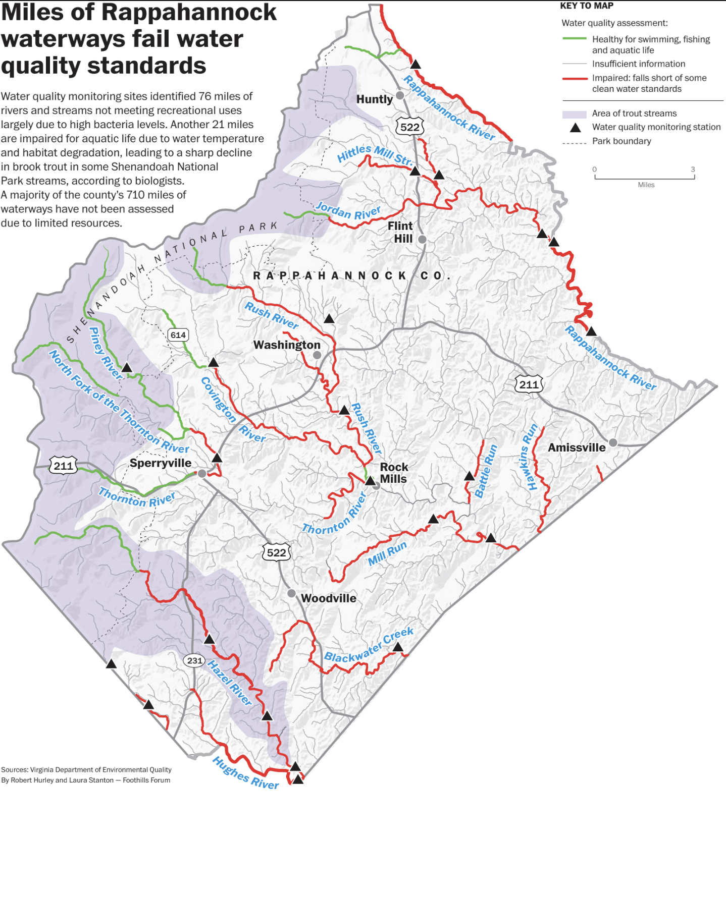
State records show almost 100 miles of local streams as being “impaired” — not meeting water quality standards — most often for elevated bacteria levels. In Shenandoah National Park, which covers about a third of Rappahannock and feeds most of its rivers, brook trout populations have collapsed on some streams that were thriving a generation ago.
Of the 710 miles of Rappahannock’s rivers and streams, 76 miles are impaired for recreational use because bacteria levels exceed state standards and 21 miles are impaired for aquatic life. Some 97 miles meet standards for aquatic life. Hundreds of additional stream miles have not yet been assessed. These figures are from the Virginia Department of Environmental Quality’s (DEQ’s) 2024 Integrated Water Quality Report.
Another 2024 study found a 50% decline in brook trout populations across about 70% of the park’s streams. The study was co-authored by Evan Childress, chief of natural and cultural resources at Shenandoah National Park.
Childress said the North Fork of the Thornton River, which runs through the heart of Rappahannock County, is among the hardest hit by rising water temperatures.
“It was a stream that 20 or 30 years ago was a great stream for brook trout,” he said. “Often there were 50 or 100 adult brook trout in 100 meters. Over the last 10 years, we’re looking at two, sometimes zero.”
Brook trout depend on cold water and begin dying when temperatures approach 74 degrees Fahrenheit, Childress said. Summer droughts reduce stream flows, allowing water to warm more quickly, pushing streams beyond the trout’s tolerance.
More than half of Rappahannock’s streams lie at lower elevations, making them more vulnerable to rising temperatures.
Forest cover inside the park helps keep streams cool, Childress said, but its benefits have limits. “That’s a knob that’s already turned all the way up,” he said. “We can’t get any more out of that in the park.”
Impaired water
Bacteria impairments are among the most common findings statewide because rainfall washes fecal from livestock, wildlife and septic tanks into waterways.
“It’s really common to go on and off the [impairment] list, based on those weather patterns and our cyclical monitoring,” said Amanda Shaver, DEQ’s water quality assessment supervisor.
In a report last month, DEQ proposed removing three county stream segments — portions of the Hazel, Thornton and Rush rivers — from the impaired waters list, according to a draft report released last month. The report also proposes a first-time impairment listing for a segment of the upper Hazel River near the Shenandoah National Park boundary.
The cycling of streams on and off the list is illustrated by the Rush River, where segments have moved on and off the impairment list multiple times since 2018. “When we sample a lot, we do often see this with bacteria where it goes on and off the list,” said Rebecca Shoemaker, a water quality assessor in DEQ’s Northern Regional Office.
Volunteers monitor streams
Every month, Bob Powers wades into the Rush River carrying test kits instead of a fishing rod. He and other volunteers with the Rappahannock League for Environmental Protection (RLEP) measure water temperature, oxygen levels, clarity and bacteria. The monitoring program has been going on for five years.
Powers, a retired chemist who lives in Warrenton, helps coordinate monitoring at three sites — the Rush River at the Rappahannock County Park and the Thornton River at Sperryville and Rock Mills. The program is supported by the River Trends Monitoring Network, a program of the Alliance for the Chesapeake Bay (ACB). The data is shared with DEQ to help assess water quality.
“Overall, we are finding that the waters at these sites are pretty clean. In particular, our data show lower bacteria levels,” said Powers.
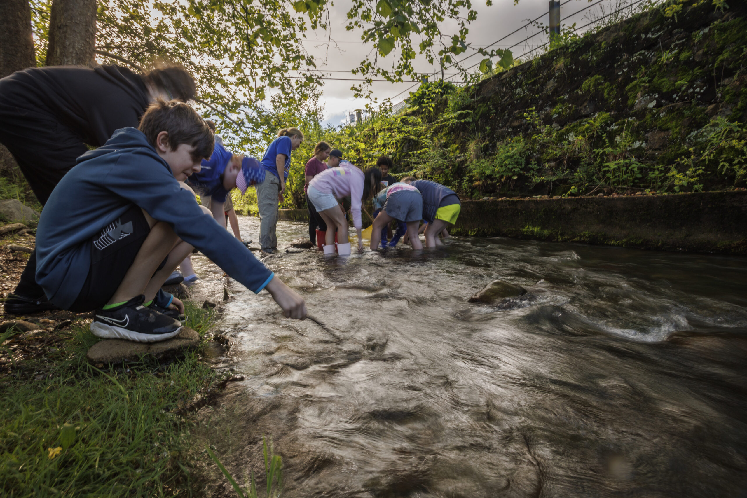
Rappahannock County Elementary students submerge a tarp in the Thornton River to collect samples at the Macroinvertebrate Sampling station. (Photo/Luke Christopher)
Another volunteer program tracks a different but complementary measure of stream health — aquatic insects known as benthic macroinvertebrates that live on the streambed itself.
For 15 years, volunteers with the Old Rag Chapter of Virginia Master Naturalists (ORMN) Save Our Streams program have monitored aquatic insects at four locations in the county: North and South forks of the Thornton River in Sperryville, Thornton River at Rock Mills and the Rush River upstream of the bridge on Old Mill Road in Washington. Findings are shared with the state.
Volunteer Mike Wenger has been chasing the waterborne critters for 11 years. He said the insects he finds indicate streams that are generally healthy.
“From a biodiversity standpoint, the streams are, for the most part, consistently healthy — well oxygenated, clear and free of chemical pollution,” Wenger said.
But Wenger cautioned that aquatic insects can tolerate somewhat warmer water than brook trout. As a result, the warming trends documented by Childress may not yet be reflected in the insect count. He also noted that DEQ impairment listings are often driven by high bacteria that do not affect macroinvertebrates.
Why local data looks different
Sophie Stern, water quality monitoring projects coordinator for ACB, said the organization’s screening method for bacteria cannot be used by DEQ to formally list or delist waterways but can flag problems for follow-up. She also noted that some state listings are based on data collected several years ago.
“The most recent data could potentially be from many years ago, when a stream was listed,” she said, raising the possibility that some local waters have quietly improved without the formal data to prove it.
“We typically see higher bacteria levels in the summer season, but they generally stay quite low,” said Stern.
Residents can also nominate waterways they believe should receive additional DEQ monitoring — a process Stern called an opportunity to “mobilize community members to advocate” for their local streams.
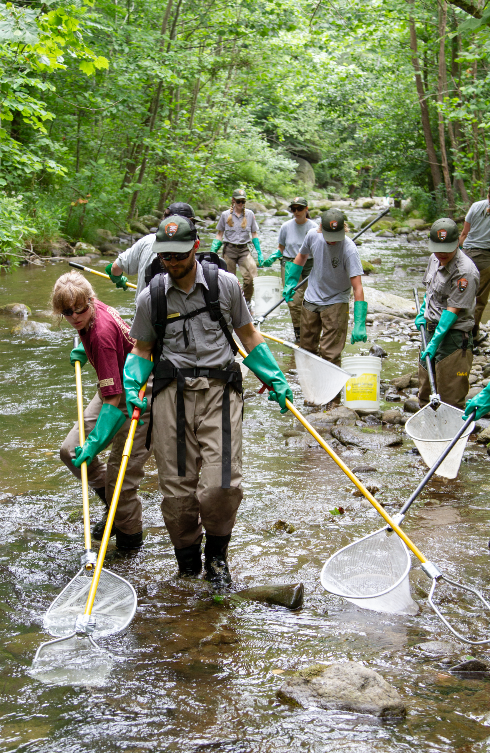
Evan Childress (forefront) with Shenandoah National Park staff and volunteers netting fish. Data on brook trout size, age and abundance is collected before they are released into the stream. (Photo/National Park Service)
Cleanup programs helping
Conservation work appears to be making some difference. Since 2008, most of Rappahannock has been covered by a federal program aimed at reducing bacterial pollution. State and federal funding helps farmers install stream fencing, plant riparian buffers — and for homeowners as well — repair and pump septic systems.
“There’s been a significant movement toward participation in programs and a lot of voluntary work done to improve water quality,” said David Massie, district manager of the Culpeper Soil and Water Conservation District that includes Rappahannock.
DEQ water monitoring supervisor Drew Garey said the agency operates 22 monitoring stations in the county, supplemented by volunteer monitoring that provides data worth millions of dollars statewide. He noted that some pollution stems from land uses decades ago, but said good stewardship remains the best way to prevent future water quality problems.
“Sometimes the impairment source is the ghost of land use past — a hog farm or clear-cutting that occurred 50 or 100 years ago that’s put sediment in the system,” Garey said.
“If folks can remember the watershed concept — everything flows downhill, therefore everything you do on the land affects the water — and if you’re good stewards of what you do on the land, that eliminates a lot of problems from the beginning,” Garey said.
Roger Flinchum agrees.
“That’s one of the reasons I’ve taught fly fishing for so many years,” he said. “People learn to enjoy and respect the water, and I want future generations to share that reverence.”
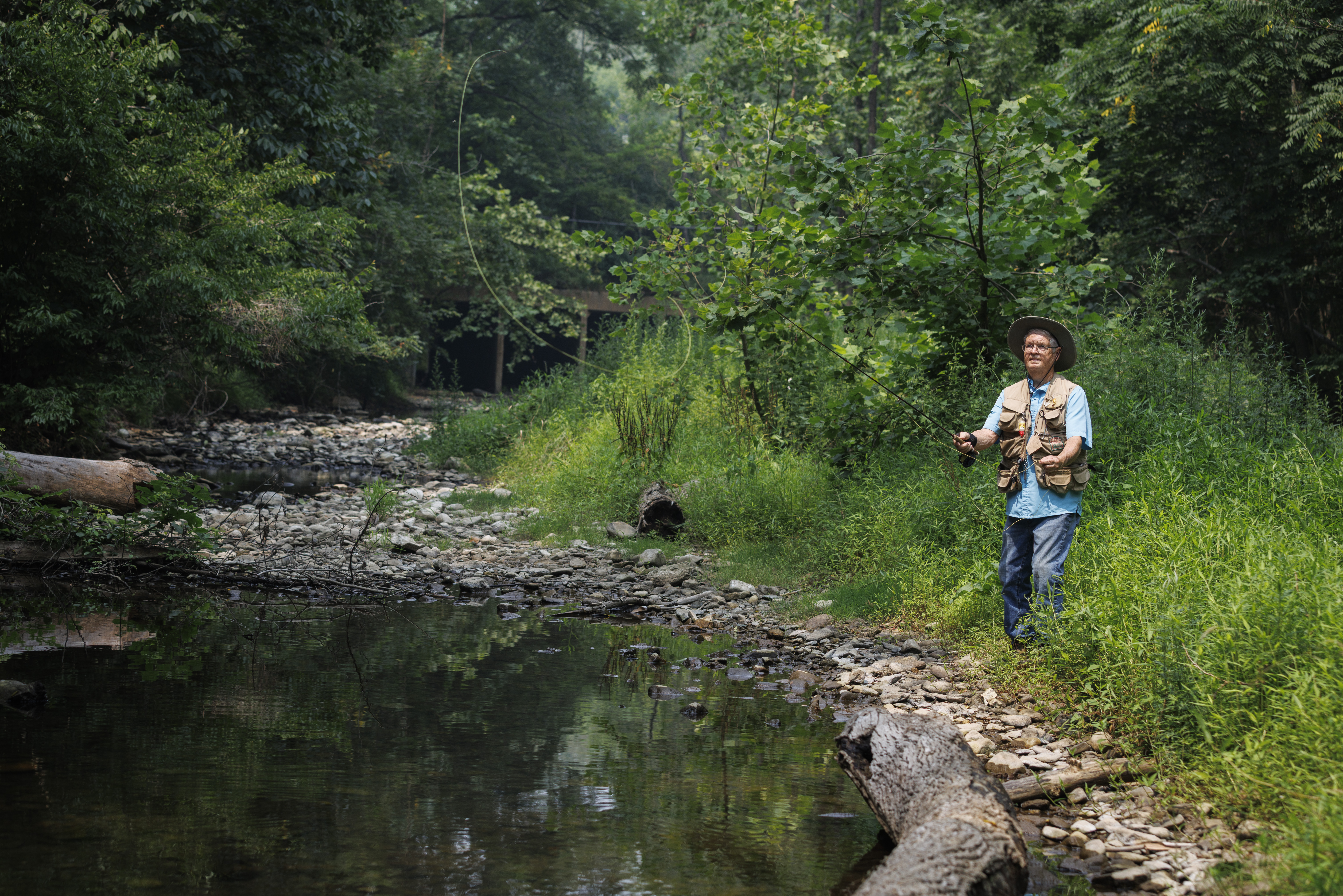
Roger Flinchum casts his fishing line into the Rush River by the county park. (Photo/Luke Christopher)