


Who’s at risk and where?
New ways to cope
The owners of The Black Twig restaurant in Sperryville know all too well the life-threatening impact of severe flooding.
Abigail Gleason was left stranded at her home the evening of May 13 with her two young sons on one side of the roaring Hughes River which had jumped its banks. Husband Dan was on the other side, calling out, but unable to reach her until the next day. Neighbors across the road, David and Suzanne Weiss, waited three more days before they were rescued.
Kay Wilson and husband, Ewen, of Washington, also know the dangers. Their 13-year-old grandson and friend were caught in an intense thunderstorm June 25, swept down the Covington River above Rock Mills during a hike, and rescued by the Rappahannock County Sheriff’s Office with use of one of its drones.
This May alone, Rappahannock County got hit with an all time record of 10.2 inches of rain compared to an average of 3.6 inches. June recorded rainfall of 3.9 inches and July 6.8 inches.
Weather officials report that severe thunderstorms have been on the rise for the past few years.

Ewan and Kay Wilson at the confluence of the Rush and Covington rivers. (Photo/Luke Christopher)
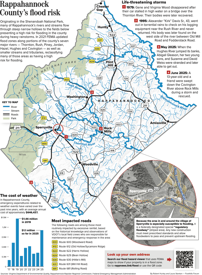
A May-June-July intense rainfall and scattered isolated storm cells wreaked havoc in many Rappahannock areas, washing out roads, stranding motorists and homeowners, and dumping sediment and other pollutants into streams. It put emergency rescue personnel on high alert, and the Virginia Department of Transportation (VDOT) on notice to begin massive emergency road cleanups of debris and repairs after the storms. As July began drawing to a close, emergency repairs from storms this year had totaled about $1.11 million, an increase of nearly 72% over the average annual cost of $646,437 since 2017.
Originating in the Shenandoah National Park, many of Rappahannock’s rivers and streams flow through steep narrow hollows to the fields below presenting a high risk for flooding in the county during heavy rainstorms.
But not many people seem to appreciate the risks of flooding events until they happen. Take the devastating flooding in Ashville, N.C. last September when Hurricane Helene dumped 13 inches of rain in over two days. Although storm warnings and flood alerts were issued by the National Weather Service (NWS), the volume of rain combined with the steep topography of the area caught many residents off guard, and swiftly rising rivers knocked out roads and bridges and caused landslides.
As Abigail Gleason said of the flooding at her home on the Rappahannock side of Nethers, “People who lived here for decades never thought something like this would ever happen.”
“Heavy rain in a short period of time can lead to some pretty devastating things. Nothing kills more people from a weather perspective than flooding,” said Christopher Strong, warning coordination meteorologist with the National Weather Service (NWS) in Sterling, who oversees weather conditions for Rappahannock.
“When you get flash flood warnings, be careful in low areas. You may need to evacuate areas by small streams and rivers. Where water rises rapidly you can get into some life and death situations pretty quickly,” he said.

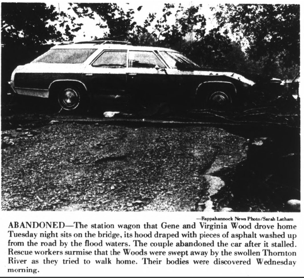
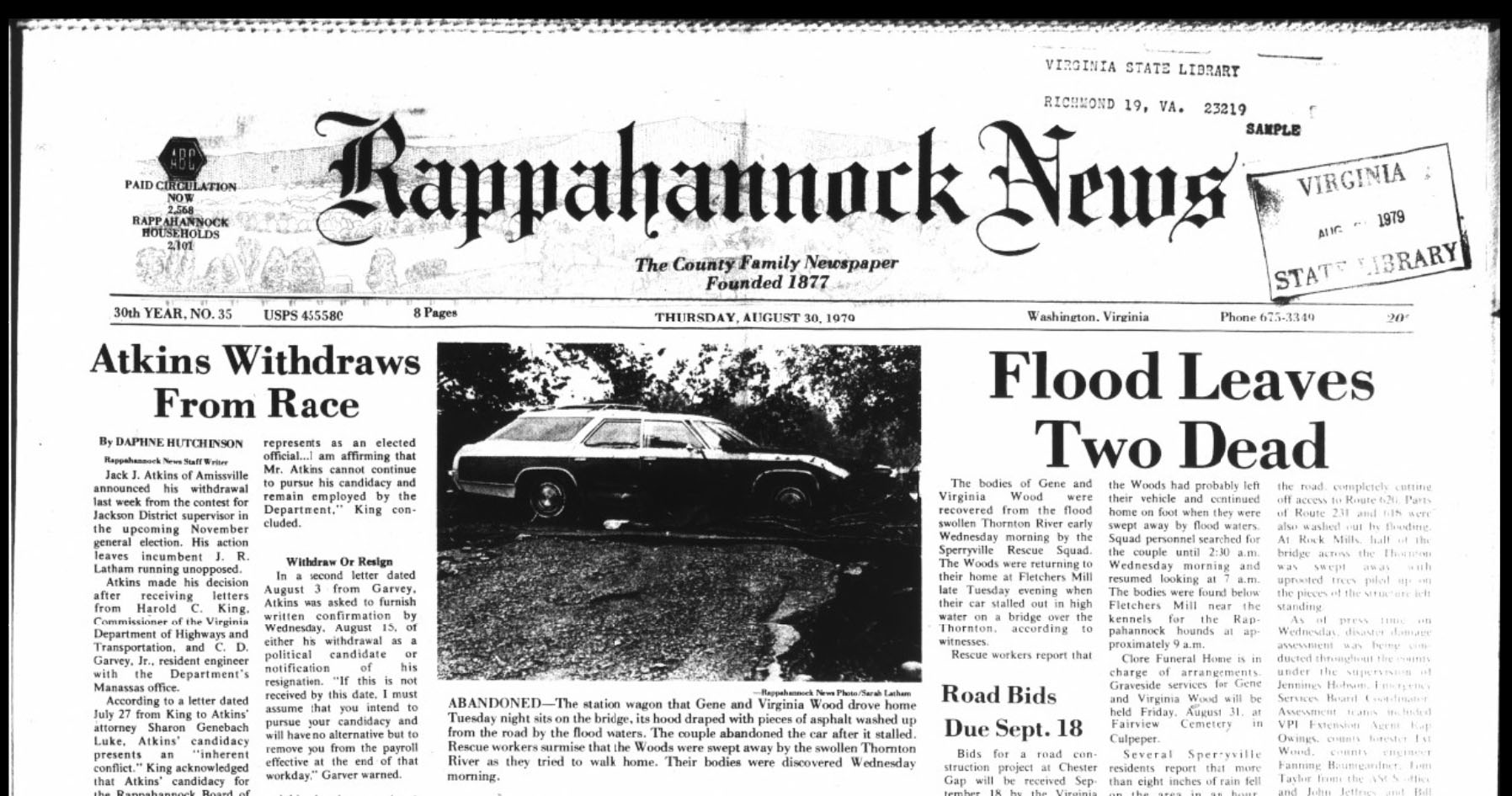
The front page of the Aug. 30, 1979, edition of the Rappahannock News, reported on severe flooding in the county that killed a local couple, Gene and Virginia Wood.
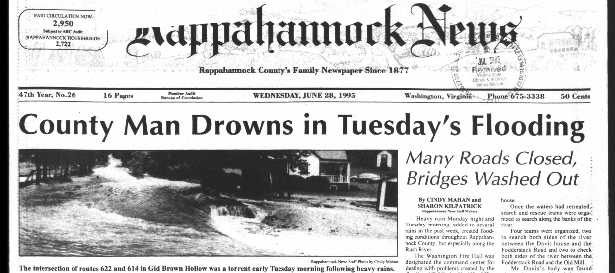
Floods take lives in 1979 and 1995
That’s what happened the late evening of August 28, 1979 when Gene and Virginia Wood abandoned their station wagon that had stalled in high water on a bridge over the Thornton River. Their bodies were recovered from the swollen river below Fletchers Mill the next morning by the Sperryville Rescue Squad. Rescue workers reported that the Woods had probably left their vehicle and continued home on foot when they were swept away by floodwaters, according to a story in the Rappahannock News at the time. Residents reported more than eight inches of rain fell on the area beginning at 8 p.m. and roads were impassable in most of the county with Sperryville being hit hardest.
On June 27, 1995, floodwaters took the life of Rappahannock’s Alexander “Kirk” Davis Sr., 43, in Harris Hollow, outside the Town of Washington. Davis, who owned his own logging business, went out in torrential rains at 6:30 a.m. to check on the safety of his equipment in a shed near the Rush River that ran in front of his family’s home, and never returned.

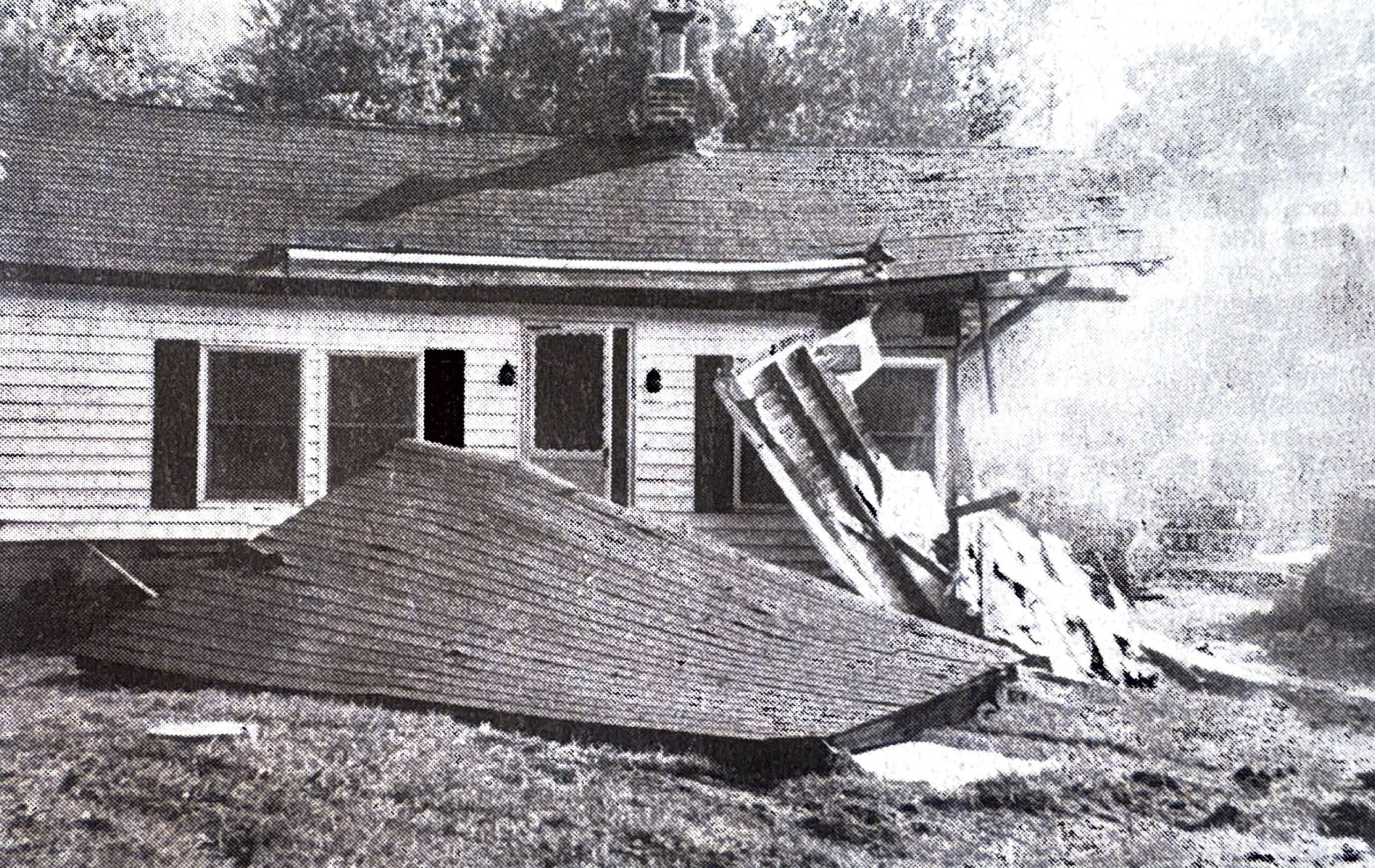
Washed out entrances were common after severe flooding in June 1995. Photo by Cindy Mahan/Rappahannock News
Search and rescue teams, state police helicopters and an air medical helicopter, Pegasus, assisted in a search for him. The Washington Volunteer Fire Department was the command center. His body was later found along the west side of the river between Fodderstack Road and Old Mill Road. He left behind his wife, Pat Davis, longtime clerk of Rappahannock’s General District Court, and their young son.
Two other people were killed in that storm system, one each from Madison and Warren counties.
Is your property at risk?
Rappahannock has seven rivers, some 25 named streams and dozens of smaller tributaries that could cause flooding, and does.
Properties along portions of these major rivers — Thornton, Rush, Piney, Jordan, Hazel, Hughes and Covington — and Rock Mills and Laurel Mills are areas of severe risk of flooding. Roads most routinely impacted by excessive rainfall include Woodward, Rolling, Mill Hill, Hittles Mill, Bean Hollow, Harris Hollow, Old Hollow and Sycamore Ridge.
In 2021, officials with the National Flood Insurance Program (NFIP) administered by the Federal Emergency Management Agency (FEMA) reviewed and reclassified floodways along Rappahannock’s major rivers and tributaries. Using updated hydrologic and terrain information, the agency determined homes and buildings in a so-called Zone A have a 26% chance of flooding over the life of a 30-year mortgage. First Street, a risk analysis company, identified 873 properties in those flood-prone areas that have a high risk of flooding in 30 years.
Structures with federally-backed mortgages in Zone A must have federal flood insurance. Property owners can check NFIP’s website at floodsmart.gov to see if they are located in a flood zone.
At even higher risk levels are stretches of the Thornton River and its north and south fork tributaries in and around the village of Sperryville. Because they are especially susceptible to flooding, they have been designated a special “regulatory floodway” by NFIP, meaning any new construction must meet prescribed building standards and be designed to allow floodwaters to pass and prevent upstream flooding.
ALSO READ: A night to remember
Thunderstorms increasing
Although the average rainfall for this year is nearly on par with the average of 44 inches annually, severe storms in Rappahannock have been on the rise. According to the NWS, some 22 severe thunderstorm warnings and six flash flood warnings already have been issued through early August. Severe thunderstorm warnings totaled 17 last year and 20 in 2023. Flash flood warnings totaled
seven in 2024 and one in 2023.
“As global warming contributes to rising air and ocean temperatures, humidity and dew points increase and that means more water in the atmosphere,” said retired television meteorologist Bob Ryan, who lives in Woodville. “Our area is particularly affected by the continued warming of the Caribbean Sea and the Gulf area, setting up the weather patterns that have led to the intense rainfall and violent storm systems we’ve been experiencing this summer,” he said.
Data collected by the National Oceanic and Atmospheric Administration (NOAA) indicates atmospheric moisture in the Virginia-Mid Atlantic region has increased almost .20% annually since 2005, for a total of about 4%.
“These moisture-laden systems have been very localized, popping up with one area getting four inches of rain while another, maybe five or 10 miles away, getting a half inch,” said Jeremy Geiger, senior service hydrologist at NWS. “Instead of water coming out of a faucet, it’s more akin to a fire hydrant and that leads to flash flooding.”
Graphic by Laura Stanton and Bob Hurley
Is Rappahannock ready?
Hampton Supervisor Keir Whitson, who chairs the county’s Public Safety Committee, said the county has a number of tools to respond to flood emergencies.
“We are becoming more proactive with our RAVE emergency alert system for both cellphones and landlines for county residents and those just passing through the area,” said Whitson.
RAVE is a county-sponsored communications system in which residents can sign up for emergency weather alerts on the county website rappahannockcountyva.gov. There’s a red box at the bottom of the web page that says: “Sign up here for emergency alerts.”
Whitson also noted that Chester Gap and Castleton volunteer fire companies have high-water rescue vehicles. The Washington fire company has a rowboat to rescue people caught in flooding situations.
“We’ve also updated our floodplain ordinance to comport with NFIP flood maps. That helps us make sure homes and buildings in high risk areas meet site standards and are built to withstand floods,” said Whitson.
During extreme widespread emergencies, Whitson said the Rappahannock County High School, now equipped with a generator, is designated as an emergency shelter for those displaced by natural disasters.

The confluence of the Rush and Covington rivers. (Photo/Luke Christopher)
New river gauges give early warnings
Last year, the Virginia Department of Emergency Management (VDEM) began deploying a network of 167 river gauges as an early warning system for rising waters in smaller tributaries that are prone to flash flooding. Five gauges are located along the Thornton, Hughes and Rappahannock rivers, along with a U.S. Geological Survey gauge along Battle Run.
“We wanted better awareness of flooding from major rain events, especially those affecting smaller streams in rural areas,” said Steve Pyle, an environmental specialist with VDEM. “When these gauges show rising water levels, we notify the county and the National Weather Service and they can issue early alerts, warning residents to evacuate, move to higher ground or in some cases, stay safely in their homes.”
When taken together, Whitson believes the emergency response resources in the county are sufficient, for now, to deal with flooding and other extreme events.
Garrey Curry, the county’s emergency management director and county administrator, said in cases of extreme flooding, where local resources are overwhelmed, outside help from the state would be called in like it was for Rappahannock’s 1995 flood.
“The flooding in May was not considered to be a big 100-year flood. People need to think about that and not be complacent,” he said.
The tragic loss of over 100 lives, many at Camp Mystic For Girls, during July’s flood along the Guadalupe River in Kerr County, Texas is still fresh in the minds of many.
“During these severe storms, people really need to pay attention to weather reports, alerts and water levels,” said Rappahannock County Sheriff Connie Compton. “It breaks my heart to think about what those poor little girls and adults went through. I can only hope that God was there to help them.”